

Navionics Platinum+ SD 904 US Ne & Canyons Nautical Chart on SD/Micro-SD Card - MSD/904P+
Product details
| Management number | 211774727 | Release Date | 2026/04/04 | List Price | $88.98 | Model Number | 211774727 | ||
|---|---|---|---|---|---|---|---|---|---|
| Category | |||||||||
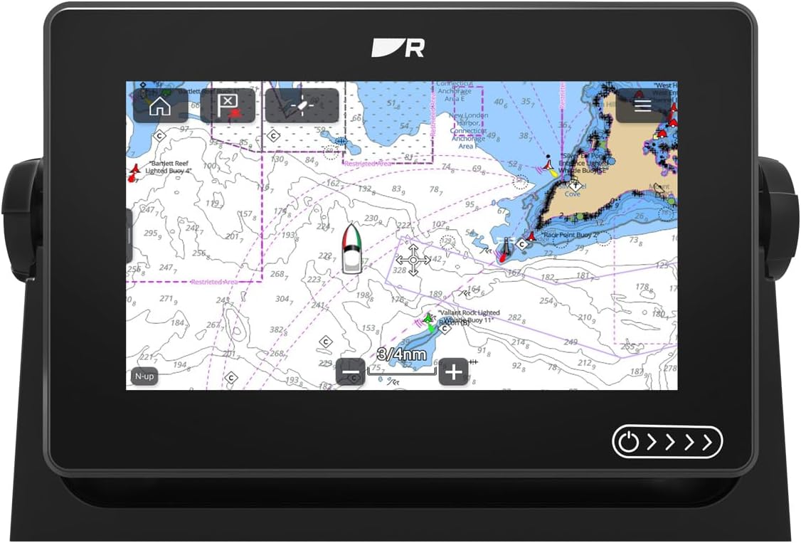
Navionics Platinum+ us northeast & canyons on SD/micro SD card, manufacturer's part number SD/904P+, covers NY, CT, RI, mA, NH, MN and offshore canyons. Navionics award-winning Platinum+ charts, the most advanced multi-dimensional marine charts available, offer navigators a selection of bonus information beyond the best available navigation charts such as panoramic pictures, 3D/2D views w/satellite imagery, complete Coast Pilot guide, poi, high-definition fishing detail, and more. Navionics has amassed the most comprehensive mapping database of its kind with more than 25,000 charts and port plans. Platinum+ Plug-and-play cartography is an indispensable component of the industry's leading chartplotter manufacturers including hummiNBird, lowrance, North Star, raymarine and simrad. Visit navionics for complete compatibility and coverage information. Features: paper chart appearance for the clearest charts and best detail full seamless presentation with IC (intelligent clarity) technology user-selectable safety depth contours navaids with explain navaid Description feature port services with telephone Numbers (where available) including fuel, transient berths, repairs, and more tides & currents high-resolution satellite photo overlay 3-dimensional view panoramic port pictures Coastal points-of-interest high-definition fishing detail for us waters.
- Detailed charts for cruising, fishing and sailing, plus 3D View, satellite overlay and panoramic port photos.
- Includes SonarChartTM one foot HD bathymetry map and Community Edits, valuable local information added by millions of Navionics Boating app users.
- Coverage area includes from Maine, Massachusetts, New York, Hudson River, North Atlantic Canyons from Passamaquoddy Bay and Grand Manan Island to Shark River Inlet, Oneida Lake, The Finger Lakes, Lake Champlain and all of North Atlantic Canyons.
| UPC | 821245904591 |
|---|---|
| Color | Black |
| Map Type | Nautical, Satellite |
| Brand Name | Navionics |
| Item Weight | 0.13 Pounds |
| Manufacturer | Navionics |
| Paper Finish | Matte |
| Item Type Name | Nautical Charts |
| Included Components | Nautical chart on SD/Micro-SD card |
| Warranty Description | Limited Supplier Warranty |
| Global Trade Identification Number | 00821245904591 |

Bestseller ranking
Marine GPS Chartplotters


Customers who viewed this product also viewed
Romance


Correction of product information
If you notice any omissions or errors in the product information on this page, please use the correction request form below.
Correction Request Form